
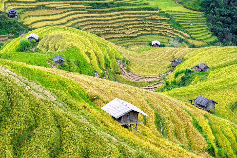
The rice terraces are one of the most photographed sights in Bali. They are also a working farm system that has run for centuries. Knowing a little about how they work makes a visit far more rewarding.
This guide explains the subak system and why it is on the UNESCO World Heritage List. It also covers how to visit the terraces respectfully. The facts come from UNESCO and Indonesia’s official tourism site.
What the subak system is
A subak is a cooperative system for managing water. Farmers share water through canals, tunnels and weirs. UNESCO says the system dates back to the 9th century and is still working today.
UNESCO describes the subak as democratic and egalitarian. Between 50 and 400 farmers can manage the water from a single source. The listing notes about 1,200 water collectives across Bali.
The system is about more than the fields. It also includes the forests that protect the water supply, as well as villages and temples. Each part depends on the others.
Water temples and Tri Hita Karana
Water temples sit at the centre of the subak. UNESCO says they focus the cooperative management of water across whole watersheds. They have guided the ecology of the rice terraces since the 11th century.
The temples hold rituals, offerings and ceremonies linked to managing water. Indonesia’s official tourism site says the water temples hold festivals every 105 days. That matches the length of the rice growing season it describes.
Behind it all is a philosophy called Tri Hita Karana. UNESCO explains that it brings together the spirit, the human world and nature. The terraces are a physical expression of that idea.
The UNESCO World Heritage listing
The listing is called the Cultural Landscape of Bali Province: the Subak System as a Manifestation of the Tri Hita Karana Philosophy. Indonesia’s official tourism site says it was inscribed in June 2012. UNESCO puts the total area at about 19,500 hectares.
The listing covers rice terraces and their water temples. Named parts include the Supreme Water Temple of Pura Ulun Danu Batur on the edge of Lake Batur. Others are the Subak Landscape of the Pakerisan Watershed, the Subak Landscape of Catur Angga Batukaru and the Royal Water Temple of Pura Taman Ayun.
UNESCO describes the Pakerisan Watershed as the oldest known irrigation system in Bali. Terraces in Catur Angga Batukaru are mentioned in a 10th century inscription. Pura Taman Ayun dates from the 18th century.
Visiting Jatiluwih
Jatiluwih is the best known terrace area for visitors. Indonesia’s official tourism site places it in Tabanan Regency. It says the drive from Denpasar covers about 40 kilometres and takes around two hours.
The terraces fall from volcano slopes into deep valleys. Walking through them is the main activity, and cafes with terrace views line the route in. Allow most of a day so you are not rushing.
Base yourself with the drive in mind. If you are still choosing an area to stay, our post on popular locations for investing in Bali villas gives a feel for different parts of the island. If you host guests in your own villa, a day trip to the terraces is a good tip to share. Our guide on how to become an Airbnb superhost has more ideas for looking after guests.
Other parts of the listed area
Jatiluwih is not the only place to see the subak at work. The listing also includes water temples that sit at the centre of the system’s ceremonies. Pura Ulun Danu Batur is the Supreme Water Temple, set on the edge of Lake Batur.
Pura Taman Ayun is the Royal Water Temple. UNESCO describes it as the largest temple of its type on the island. The Pakerisan Watershed holds the oldest known irrigation system in Bali. Visiting one of these sites as well as the terraces gives a fuller picture of how water, farming and worship connect.
How to visit respectfully
Remember that these are working fields. Farmers depend on the terraces and the water channels for their living. Treat the area as you would a farm at home.
Stay on paths and the edges of terraces where walking is clearly allowed. Do not step into planted fields or block water channels. Ask before you photograph people at work.
Temples within the landscape are sacred places. Dress modestly and follow any signs or directions from local people. If a ceremony is under way, keep your distance and stay quiet.
Protecting the terraces
UNESCO lists several pressures on the site. These include social and economic change, changes in farming practices and pressure from tourism and development. Water management also matters greatly to how the terraces look.
A range of laws and plans protect the area. UNESCO notes that a Tabanan Regency decree from 2005 protects rice terraces from large scale tourism development. Subak communities also have customary codes, known as awig-awig, that govern membership and protect sacred sites.
These rules matter for anyone thinking about property in Bali too. Our article on pitfalls to avoid when buying a Bali villa covers some of the legal traps. The Tabanan decree above is one example of a local rule that limits development.
Planning your day
Carry some cash for parking, entry and food. Prices can vary, so check locally on the day. Our list of things you will need money for when staying in a Bali villa helps with budgeting more generally.
Wear shoes with good grip, as paths can be muddy and uneven. Bring water, a hat and sunscreen. A light rain jacket is handy in the highlands.
Before you go, read the UNESCO World Heritage listing for the Cultural Landscape of Bali Province. It explains the history and values of the site in more detail. Knowing the story makes the walk through the fields much richer.
Frequently asked questions
What is a subak?
A subak is a cooperative system for sharing irrigation water between farmers. It uses canals, tunnels and weirs. UNESCO says it dates back to the 9th century.
When did the subak system become World Heritage listed?
Indonesia’s official tourism site says it was inscribed in June 2012. The listing is called the Cultural Landscape of Bali Province. It covers about 19,500 hectares of terraces and water temples.
How far is Jatiluwih from Denpasar?
Indonesia’s official tourism site puts it about 40 kilometres away. The drive takes around two hours. Traffic can change that, so allow extra time.
Can I walk through the rice fields?
Walking through the terraces is the main activity at Jatiluwih. Stay on paths and edges where walking is allowed. Do not step into planted fields or block the water channels.
This article is general travel information only. Access, fees and local rules can change. Check with official sources and local operators before you visit.